
Learn more about Trustee Area 1!
As of August 9, 2026
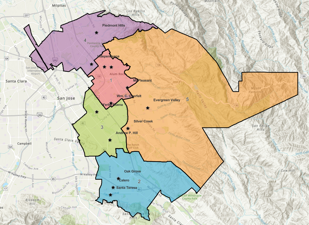
Where is Area 1?
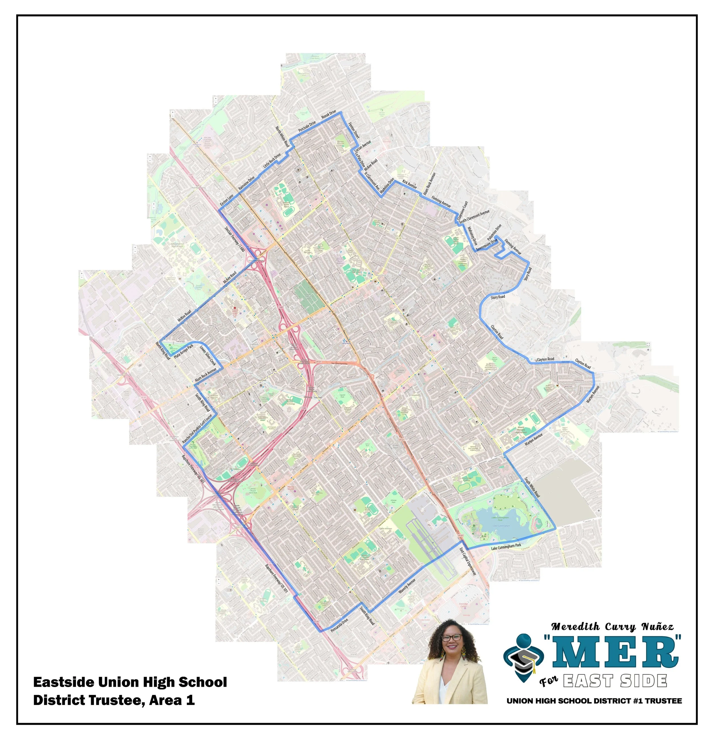
Check out the map to the right and click on the button to download it so that you can zoom in to explore the neighborhoods. Note that this is not an official map.
Using this unofficial map, we can define the borders of Trustee Area 1 as follows:
To the West: King Rd. at Plata Arroyo Park before wrapping around Checkers Dr., S. King Rd. then the 101 freeway
To the East: Fleming Ave., Clayton Rd., and then S. White Rd. at Marton Ave. to wrap around Lake Cunningham Regional Park
To the North: Easton Ln and McKee Rd.
To the South: Waverly Ave. cutting into the Reid-Hillview County Airport, into Cunningham Lake
Trustee Area 1 includes the high schools James Lick, Mt. Pleasant, and W.C. Overfelt,
Area 1 also included landmarks like the neighborhoods of Alum Rock, Mt. Pleasant, Joseph George, Lyndale, Mayfair, Sierra Vista, and Tropicana. Local landmarks include Emma Prusch Farm Park, Lake Cunningham, Rancho del Pueblo Golf Course, Regional Medical Center, and Reid-Hillview County Airport.
-
As of 8/8/2026, in addition to Mer Curry Nuñez, there will be two other candidates on the ballot.
Stay tuned for instructions on where you can find Mer on the ballot (the order will be randomly selected).
-
November 3, 2026. This election does not have a primary in June.
-
The trustee area lines have been drawn for the first time for ESUHSD. Use this tool to figure out if you’re a Trustee Area 1 resident!
From Look Up Your Districts, enter your full mailing address and click on Go. Scroll through the results to find your East Side Union High School District Trustee Area # under the category SCHOOL DISTRICTS - HIGH SCHOOL.
-
You can register to vote or check your voter registration using the link below!
The last day to register to vote and receive a ballot by mail is October 19, 2026. After October 19, voters can still register and vote in person at a polling place on Election Day.